
Spatialisation and memory mapping: an artistic cartographic method for reconstructing the city
 Lists
Lists Lists
Lists


Wacta, Christine and Liu, Xinyi (2024) Spatialisation and memory mapping: an artistic cartographic method for reconstructing the city. In: Proceedings of Relating Systems Thinking and Design, RSD12, 06-20 Oct 2023, Washington, D.C., USA.
![[thumbnail of Wacta_ReconstructingtheCity_Gigamap_2024.jpg]](https://openresearch.ocadu.ca/id/eprint/5176/1/Wacta_ReconstructingtheCity_Gigamap_2024.jpg "Wacta_ReconstructingtheCity_Gigamap_2024.jpg")  Preview |
Image
Wacta_ReconstructingtheCity_Gigamap_2024.jpg Available under License Creative Commons Attribution Non-commercial No Derivatives. Download (571kB) | Preview |
Preview |
Text
Wacta_ReconstructingtheCity_Paper_2024.pdf Available under License Creative Commons Attribution Non-commercial No Derivatives. Download (463kB) | Preview |
Abstract
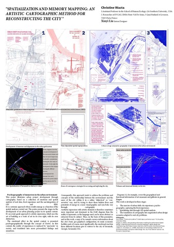
This poster is an artistic illustration of the architectural project from ideation to final proposal. The process follows a Geospatial Game of the Unknown, an approach that uses science and suitability studies to find evidence of historical significance about a place and in comparison to current socioeconomic and cultural trends. It engages using predictive analysis to map suggestions about the best solution for the future of the place in terms of human needs, lands, and nature. At the start of such a process, the site location, and program details are unknown, and emerge from cross-referencing data layers to validate location, and programs based on the population’s past-present, and future needs for work, leisure,, and the suitability of the land. The creation process involves pictorial illustration of the environment experience trough a spatial engaging represented in cartographical illustrations that use mixed media (hand + Digital) to artistically tell the story of the systemic process of architectural design. The poster encapsulates the idealism of storytelling with the practicality of Building Information Modeling (BIM). The use of the contrasting medium helps each viewer to connect at a different and unique level since the Artistic content does not need to be explained but embodied by each visitor and visualized in a way that highlights the interconnected subsystems to allow individuals to read and understand the City System their own way. This process adapts to La Derive theory as presented by “Les Situationists” (1956), a methodology applied to pedagogy to introduce the complexity in the system of thoughts and understandings that exist in the intertwined urban realities (historical, human habitus, economics, temporal events). In this poster, the evolving geospatial technology is used to help connect humans and their environments. The proposed location for this project (near the Savannah Riverfront) is informed by the geospatial diagnostic and suitability studies.
| Item Type: | Conference/Workshop Item (Paper) |
|---|---|
| Uncontrolled Keywords: | spatial thinking, urban realities, historical contexts, systems, timeline |
| Divisions: | Faculty of Design |
| Date Deposited: | 02 Jul 2026 16:33 |
| Last Modified: | 02 Jul 2026 16:45 |
| URI: | https://openresearch.ocadu.ca/id/eprint/5176 |
Actions (login required)
 |
Edit View |